Using tech to help cyclists get from A to B
Jason Farra
July 3, 2019

The City of Ottawa installed its first separated bike lane in 2011. Since then, the number of residents choosing to bike around the city has been growing as the national capital’s network of bike lanes continues to expand.
However, the path between A and B for local cyclists can still sometimes involve sharing the road with drivers, something which can be uncomfortable even for veteran two-wheelers.
“It’s not just about where you can go, it’s about where you want to go,” says Heather Shearer, President of Bike Ottawa. “Traffic stress is one of the deciding factors in whether or not a route is comfortable enough to bicycle on.”
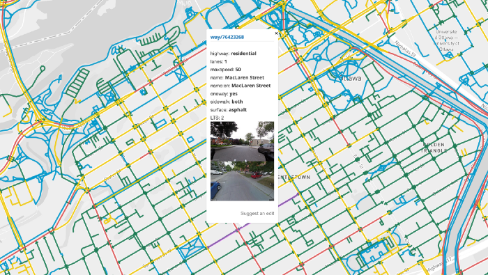
The City of Ottawa uses the level of traffic stress to assess the quality of its cycling infrastructure — but they didn’t have a map that actually shows the traffic stress of roads and paths across the city.
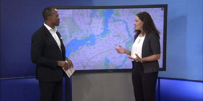
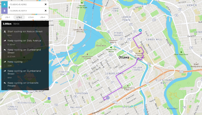
In response, the city’s cycling advocacy group created that map themselves, as part of a set of interactive maps. The maps not only help people interested in biking choose quieter and more comfortable routes, but also show important data that could assist with advocacy and planning efforts.

The maps include everything from which bike pathways are plowed and maintained during the winter to where collisions have occurred on Ottawa’s roads.
The project got started when a Data Group was created within Bike Ottawa, bringing together a core team of six people — including Heather — who were also involved with other groups in the city, such as OpenStreetMap Ottawa and Ottawa Civic Tech.
As a volunteer with both groups, Matthew Darwin was excited to join the Data Group and contribute his mapping and technical expertise to the project. He saw it as an example of how civic tech groups can help facilitate collaboration with other organizations in their cities.
“I think it’s more about building the relationship and network between all the different people rather than doing a specific project that’s branded as an Ottawa Civic Tech project,” he said.
A supportive councillor and cycling advocate, Jeff Leiper, used his office budget to provide a small grant to Bike Ottawa. The funds really helped to accelerate the project, and were used to purchase cameras and pay for meeting space and web hosting costs.
“One thing that this project has highlighted is that the City can be a great partner in making amazing data projects happen,” Heather said.
“In return, we produced a report on these mapping tools for the City — how they might be useful in the Transportation Master Plan process to identify opportunities to improve the bike network,” she added.

Since releasing the maps, Heather says Bike Ottawa has heard from many cyclists who said the tools have helped them discover safer, less stressful and more enjoyable routes through the city.
“To me, that was the best feedback and made the whole project worthwhile,” Matthew said.
Having seen the impact of taking open data and “presenting it in a format that’s accessible to the typical human,” Bike Ottawa is keen to continue its mapping collaboration with the local civic tech community.
“I want to keep going. There are lots of other projects that we can imagine,” Heather said.
“The more we can put in using OpenStreetMap as a common database, the less work we have to redo every time we want to do another civic tech project.” – Matthew Darwin
And as a great example of how the openness of civic tech projects can help them scale, Matthew says there’s interest from Civic Tech Waterloo Regionin forking the map project to help cyclists in Kitchener-Waterloo.
“What we’ve done can be totally redone in other cities,” he said. “I want to do civic tech projects that can work across the country.”
Head over to the Bike Ottawa website to check out the maps for yourself.


